Mercator Map Projection
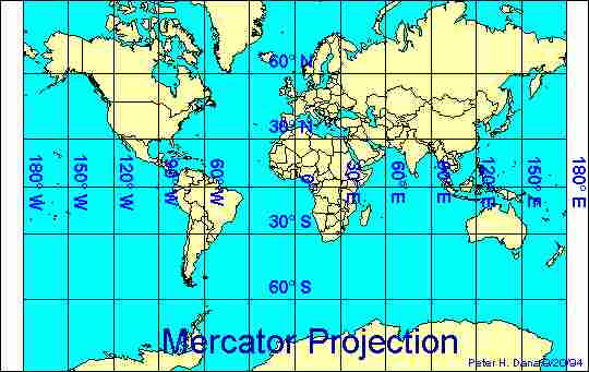
The Mercator map projection is the
basic map projection, where there is minimal distortion at and around the
equator but countries like Greenland and Antarctica look very large. This
invention may seem obvious, but in fact it is not. It is specifically
centered on the equator, so the Chinese would have had to know the exact
location of the equator and their location relative to it. This is an
extremely difficult task, given that their instruments for measuring were far
less accurate than those we have today.
Date of Invention: Inventor: Importance to Chinese civilization: Importance to other civilizations:
940
AD
Unknown
The projection
demonstrated advanced geographical knowledge. The maps that it was used to
produce helped oceanic travelers plot and follow courses to wherever they
wanted to go. This helped increase trade and encourage exploration.
Was used to produce
maps that helped other civilizations in the same way they helped the
Chinese.
Back to Table of Contents